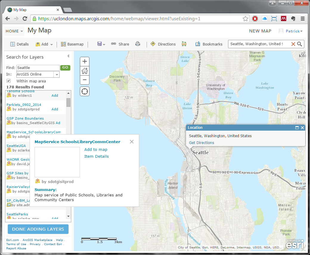
Types of Layers
From these results, you may see various layer names, types, authors and the ability to Add the layer to your map. You may see various types, such as Map Image Layer, Imagery Layer, Tile Layer and Feature Layer. Map Image Layer, Imagery Layer and Tile Layer are types of Raster layers, or those which have continuous information for its area of coverage (e.g. base maps, heat maps, etc.), whereas Feature Layer is a type of Vector layer, or those which represent discrete information (e.g. points, lines, and areas). Find the layer MapService_SchoolsLibraryCommCenter in the results; you can see its layer type and that it was published by a user named sdotgisitprod that shows Map service of Public Schools, Libraries and Community Centers. Click on the name of the layer; this will bring up a pop up window that displays a little more information about the layer – should you wish to see full details of the layer, you may click on Item Details to be redirected to the layer’s information page. Click on Item Details to do so.
excellent. are there any more of these tutorials, let me know please. thanks
Glad you enjoyed! If you’d like any more lessons or perhaps the same lessons in a different context, click the link at the top of the page for “Request a New Context”, fill out the form and submit it (I’ll get an email of it); otherwise, click the link to “Leave Feedback” to leave me general feed back (which again is a form that will get emailed to me).