Check out my blog post on my presentation of Dr. Claire Ellul, Nart Tamash, Feng Xian, Dr. John Stuiver, and my work on Spatial Metadata on the Extreme Citizen Science (ExCiteS) blog.
Check out my blog post on my presentation of Dr. Claire Ellul, Nart Tamash, Feng Xian, Dr. John Stuiver, and my work on Spatial Metadata on the Extreme Citizen Science (ExCiteS) blog.

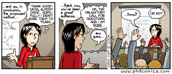
Check out my blog post on Dr. Claire Ellul and my session on GIS in Interdisciplinary Research on the Extreme Citizen Science (ExCiteS) blog.
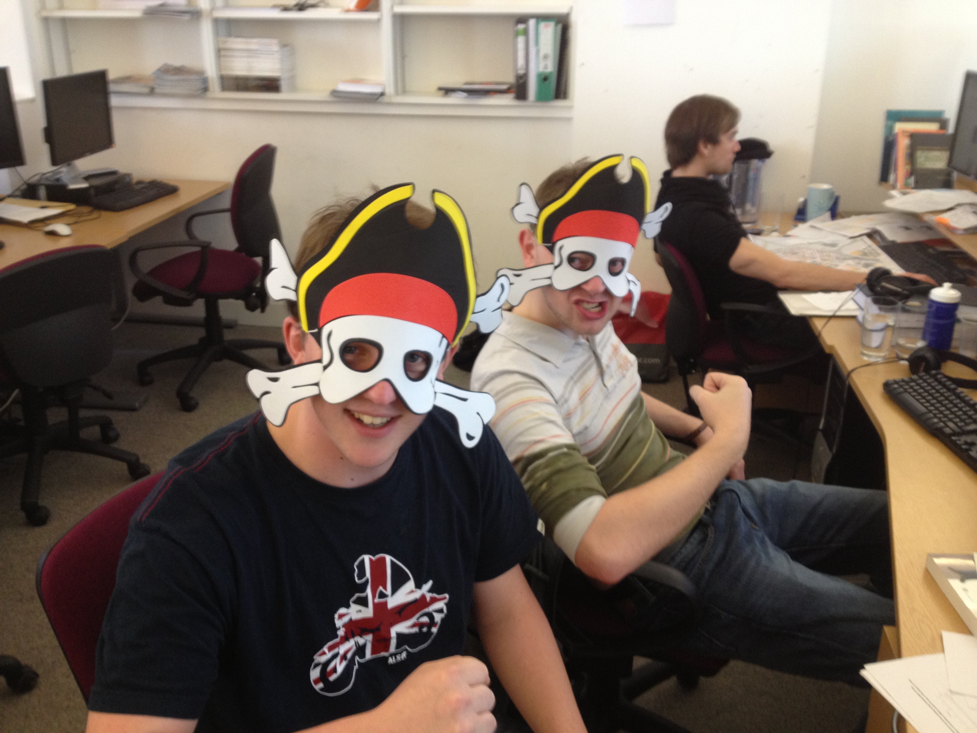
YARR, ME MATEYS! We’re after yer maps, ferget the treasure!
The salty dogs in this picture are the guys from the Geography Department that sit in the same area as the rest of us from the Extreme Citizen Science (ExCiteS). Most of them have been there now since the beginning of the academic year (a few even longer than I’ve been here), and yet we’ve never really talked.
A month or so ago, we all attended GISRUK (check out my blog about it on the ExCiteS blog) and I had the chance to actually see what they were researching – some very cool stuff and definite cross-overs with our own research group’s projects – so why have we never chatted before? The conference was a great way to get to know them; lots of good fun, lots of booze, and a chance to really get to know the people we work around (and hopefully we can work with in the future).
At the conference, I told them that, as a joke, their area has been referred to as “Geography Island” (as they’re this somewhat solitary entity surrounded by the rest of the ExCiteS team) and they totally reclaimed it. There was talk of bringing in palm trees, parrots, and rum (all of which sound great to me) and the rest of the people we were hanging out with got a kick out of it. @AngharadStone, the Environmental Agency’s savvy GIS specialist, got such a kick out of this, a few weeks later she sent pirate masks to go with the theme. We were in stitches and decided to take a few photos to share with Angharad (we were rebuffed for the lack of other pirate décor, as was discussed).
The thing I took back from all of this, though, is that we are lucky, working in research, to have such brilliant, like-minded people around us, who we can share our knowledge and time with – it just takes saying “Hello” and looking at the bigger picture; that, though your current projects are important, the next collaboration, or even a friend, may be right next to you, but you’d never know unless you said anything.
It’s how it goes, though, isn’t it? Life hits a busy patch and before you know it, months have gone by. I wish I could say that I’ve been on holiday all this time (mind you, I’ve had a few excursions; I particularly enjoyed Morocco), but I’ve mostly been busy with work. After August, my schedule mostly filled up with development work on Community Maps for Mapping for Change and ExCiteS. I also had great opportunities teaching for CEGE and the DPU, and the privilege to manage junior staff to help out on tasks for GISRUK where I got to see some cutting edge research with great representation from academia and industry alike; you can check out my blog post on the conference on the ExCiteS Blog.
Beyond that, however, there’s been some new direction in my own research. As I am based out of the Department of Civil, Environmental, and Geomatic Engineering, GIS is still very much a part of my work; being a part of ExCiteS, Interdisciplinary Research is still core as well; however, through my research, a resounding them that kept coming up was Education. Being given a GIS and asked to use it without any instruction could be likened to that of being given a car and being asked to drive. Sure, you could figure it out, hopefully with as few scrapes as possible, but the frustration of using it may outweigh your continued desire to want to use it. GIS can be an important tool for research, and I’ve seen social scientists involved in interdisciplinary research projects want to use it, in principal… but, after three or four attempts of trying to understand it, they’d just rather have someone else do it – the “map person”. As part of having that, they experience a disconnect with the data an the processes that are involved, which leaves them with an unrealistic understanding of what really goes into the analyses; this can ultimately lead to negative outcomes, not only for the person, but the team as well.
All it could’ve taken to move past that frustration was a little help – bespoke instruction and education on how to use the GIS, BUT taught through the eyes of their discipline, not the “map person’s”. And so, this is where I’m currently at, and the challenge I am facing: how do I learn to teach people in Interdisciplinary Research how to use GIS?
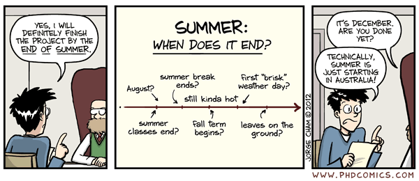
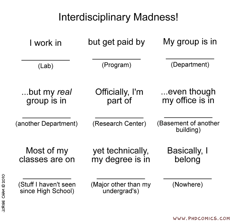
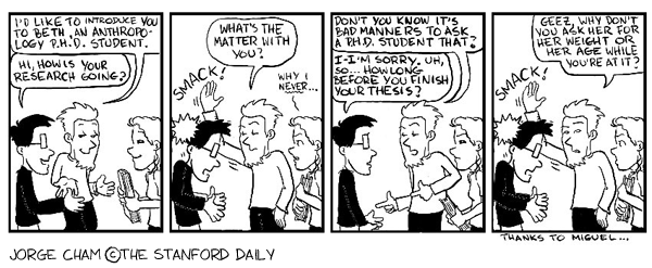
So I’ve been perusing PhD comics to add some imagery to quotes, when I came across this one on interdisciplinary research:
From the 3rd to the 5th of July, the Royal Geographical Society held its Annual Conference in Edinburgh. It was an honour and delight to attend, not only for finding like-minded scholars, but to see the interesting research everyone is doing. In my own research, albeit early days, I’m looking at how to efficiently and effectively teach GIS to interdisciplinary teams in graduate level research; although I have a solid background in GIS, I still have much to learn about teaching in higher education. The sessions held by the RGS’ Higher Education Research Group were inspiring and I definitely plan on attending their future events.
Outside of going to as many sessions as I could do, I was also there to chair one, with the support of my supervisor, Dr. Claire Ellul. Our session, titled “Geography in Interdisciplinary Research: Threat or Opportunity”, brought together speakers from around the UK to recount on the challenges and successes they’ve had in their own interdisciplinary research projects. This included Dr. Scott Orford (Cardiff University), Professor Catherine Hennessy (University of Plymouth), Dr. Christopher Boyko (Lancaster University), Kim Hagen (The Open University), and Ed Sharp (UCL). Interdisciplinary research is a difficult balancing act, where you have to establish a common dialogue with those from other disciplines, allow extra time for learning about those fields, and all the while making sure to fulfil the requirements of your own. Some emerging themes from the session were as follows:
• Researchers need to learn the nuances of the other disciplines involved in a project in order to properly appreciate their analytical methods.
• It is important to find a central theme to link the disciplines involved on a project together.
• Adjusting to different aspects of an interdisciplinary project, in particular the technologies utilised, can be daunting, but it is important to push through it and not be discouraged.
• Interdisciplinary research can mean different things to different people; the expectations and outputs should be agreed upon early, and regularly revisited.
• Continual interaction and communication is extremely important to build formal and informal ties with the different researchers.
As a researcher involved in a few interdisciplinary research projects, in particular Adaptable Suburbs and Extreme Citizen Science (ExCiteS), all the experiences shared have been extremely helpful and I hope to incorporate the lessons learned. Through improving upon and continuing to push forward with interdisciplinary research, we can hope to make something better, together, than we could do on our own.

Last week I attended the ESRIUK User Conference to see what new developments were happening with ArcGIS 10.1. With coming back to academia, I’ve made note of how important it is to go for conferences and network, however, there are definitely different ‘flavours’ of conferences. ESRIUK and AGI in particular, are two that I regularly go to, but are almost entirely geared with a major slant towards industry. Being that I’m in academia now, it’s not the same game, but it’s nice to sort of keep on top of what’s going on. Further to that, given the rest of the people in my department, with roughly the same skill set, I’m probably the best candidate to go to these, given that I have the time and the experience in industry.
One thing that’s taken a bit of adjustment for coming into this department, specifically, is that some time a few years ago, there was a purposeful shift AWAY from ESRI products (which was odd, as I used to work for ESRI). It’s true that in teaching GIS, you don’t simply want to teach ArcGIS (and I do appreciate in our department now, we are training students on MapInfo, QGIS, Geomedia, etc.), but it should not be discounted/deliberately forgotten, as it is still a powerhouse of an application and the de facto GIS package of industry. To not train students on it is failing those that hope to go out afterwards and wish to be competitive in the current job market.
As a slight tangent (though relevant), I have been making systems for about 7 years now. It’s always been a pleasure to sit down with people, listen to what they need, make it for them and give it to them. I like the challenge of starting off with a blank canvas and designing the system, the components and structuring things. Even when given a system that’s already in place, I like looking at it, analysing it, and ripping it apart to rebuild it and make it better.
While at the conference, I met up with an old co-worker and was pleased to find out that the system that I developed for them 3 years ago is still in use and being improved upon. There was a sense of pride and joy hearing that; that I made a visible difference – an impact – and by my work, am still remembered to this day at the company that I have since moved on from. So perhaps it’s not even so much creating the system and dealing with the challenge, but rather, I like making things that people need and use.
Since coming back to academia, I’ve had to adjust my own world, to (re)learn how things work here (though I don’t think I knew it to the level that I know now). There’s no compartmentalisation of duties and responsibilities – there is either very little protocol or two much red tape, so you’re haphazardly trying to wade through things. Don’t get me wrong, though, sometimes that’s the bit that’s a lot of fun (the former, usually; the latter, rarely).
When making systems in industry, a good business case needed to be put through. Wording had to be thorough; savings needed to be immediately apparent (and profit as large as possible). Here, in academia, people say “wouldn’t it be nice to have…” or “ooh! we should make…” and that is quite often it. I’ve made a few systems since I’ve been here, and helped towards others, and though the objectives have been met, the uptake isn’t there.
Before this conference, I didn’t pay that fact much attention; afterwards, though, it’s really got me thinking that I want to start making things again that people really want. Perhaps it means thinking outside of the box, or rather, thinking outside of people’s policies. I like the ideas of innovation and design – of utilising open source technologies – but it really comes down to the end users and what they want. ArcGIS 10.1 has some really cool features and supplementary systems; some of which I’ve reinvented in an open source form… that are not being used. I think the moral of this story is rather than to continue to pour effort into making the users (and myself) use and be sold on these systems, that I start making things, not only that they COULD use, but rather, they WANT TO use and if that means utilising ESRI technologies, then that’s what we use, people get over their hang-ups, and we move on to start producing results.
My apologies to anyone who has legitimately posted a comment to any of the posts I’ve made; again, I haven’t been on in a bit, but I do check my emails to see that comments have been made. The problem, though, is that most of them are from stupid spam bots, and I really couldn’t bother to go through the hundreds of comments to find the handful of legitimate ones (sorry). I’ve also switched all my posts to have comments/pings off so I don’t have to deal with that nonsense anymore.
If you’ve been following my posts or are interested in my research, please provide any feedback to my Twitter account (@mapperpat).
After things were back on track with work, I had to block out work, people’s requests for help, and other distractions (as best as I could do) to refocus on PhD work (as I felt it had been neglected for a bit). I’m quite lucky in that my supervisor likes to meet every two weeks to give guidance/make sure I’m on track (I don’t know how I’d do with one who was, for the most part, non-existent). With a rewrite of my upgrade introduction due (which I’ll likely rewrite a number of times as I try and solidify the concept), I couldn’t afford to leave it to the last minute.
In our last meeting, and perhaps in the past few, I seem to be talking around the research focus/question rather than nailing it. Like a fly buzzing around something; it’s slightly frustrating – you feel like you’ve almost got it, but you don’t. Anyway, in the previous meeting, I had received feedback on my initial introduction review and was given pointers on how to write these sorts of things. The reader must be lead on a journey, with baby-steps along the way and references to back up any assertions made. My initial draft, though decently written, was a bit too jumpy. This second rewrite was also said to be jumpy, however, the outline that I made for it, for the initial descent into what I think the research question is, was received quite positively and seemed to hit the nail on the head. It was quite pleasing to get a bit right, after buzzing around it for so long.
I’ve now been tasked with doing a more thorough literature review of the part I got, but to bear in mind the next bit, which I’m still questioning.
Up until this point, I’ve been trying to “weave” three strands together: GIS, HCI, and Interdisciplinary Research – that the three concepts are bound together, if not in my main project, in all the projects that I’m working on. All the GIS that are used in the Interdisciplinary Research we do have an interface that can be improved by HCI principles, and I can do usability studies on all of these for my own research; but that’s still buzzing around the issue, not nailing it.
From the part I got, after boiling the things down and asking at every step along the way “So what? Why does it matter to anyone?” I came to the important part about all of this (and my research): time. With all these interdisciplinary research projects, people from different disciplines are coming together and need to formulate a common dialogue – and they don’t have a lot of time to do it. It’s not like people can go back and do a BSc/BA or MSc/MA in the other discipline(s); they need to learn what they need to learn from the other discipline(s) in order to do their analyses/contribute to the teams’ analyses.
This is where I’m of two minds about this:
Option 1 – through the systems that people are using, a well designed interface can lead to a quick and successful uptake
Option 2 – through the correct training and support (tutorials/resources/additional help), uptake can be quickly, successfully, and sustainably achieved
In Option 1, thinking about things now, I feel like I’m trying to fit a square peg in a round hole. So I make a “pretty” interface – so what? A well designed one lends itself to learning how to use/navigate within that thing (website, application, or otherwise); but we’re not using ANY application, we’re using a GIS… To do graduate level research… This is a bit more than finding the closest pub. Will I be able to develop an interface that makes spatial interpolation self explanatory? I’m sceptical…
On the other hand, in Option 2, I can have a direct impact on speed of uptake. I would need to figure out how to measure skill level, pull together materials, and measure how long it takes with or without those materials. Interface usability may be a part of that, but how big of a part is questionable (certainly not as big as I’ve been seeing it).
So, shifting from HCI/GIS in Interdisciplinary Research to GIS Learning in Interdisciplinary Research… This wouldn’t be the first shift in my research (and likely not the last), but I guess it’s all part of the PhD journey. As I refine the first bit of the boil down, to where time is identified as the most important factor, I’ll need to continue reading/pondering these topics, to make an informed decision about where to lead things in the future.
As the old saying goes, “you can lead a horse to water, but you can’t make it drink.”
It’s been a while since my last post; I’m starting to understand the troubles that one can face, when balancing a part-time PhD, full-time job, and still trying to have a social life/keep sane during the whole thing. There are ebbs and flows; some weeks it’s almost all work, no PhD; others, it’s the other way around.
These past couple weeks seem to have been more work than PhD; some servers and systems that I had developed, in the process of a server reshuffle, decided to stop working on me, right before an important demo (as these things tend to do; they can’t fail on a normal day where it doesn’t matter, certainly not). After that debacle, it was a matter of getting things back online, and with some slight modifications and improvements thrown in along the way, I managed to get everything running again (as well as become an expert in installing PostGIS on Linux).
Anyway, I probably could’ve identified if/when these things weren’t working if people were actually using them. Further to that, the hurry to get things back online was moreso for my own purposes -their uptake has been rather… slow/non-existent. I make systems and analyse them because I think that’s interesting: there’s a problem and I create a system that provides the solution. Does it help people? Does it make life easier? Does it make business run more efficiently? I can’t really answer those questions if no one’s using the things I made.
I’m reminded of a project I had at previous place of employment where I was to make a toolkit to help flood modellers do their work more quickly. It seemed that they were getting bogged down in the details of GIS, rather than applying their domain specific knowledge to the stats the GIS was to output. So, after analysing their workflow, I figured out what could be automated, created the necessary tools, and provided bespoke training/documentation on them. Let’s just say it didn’t go over very well; the project was requested by upper management who weren’t pleased with the amount of time needed to do the analyses, the team were upset about how things were handled because they felt their expertise was being marginalised/belittled, and my team were caught in the middle of this, just trying to help.
My guess is that solution has ended up in a code graveyard somewhere, which is a shame. I make things to make people’s lives easier, whether they’re aware of it or not (usually the latter), but I don’t mind – I learn some great things along the way and always work towards improvement. I just hope that for this current project, uptake of the systems improves, not only for management’s sake to get the outputs it needs, but for the team’s sake – manually taking care of this at the end of the project (while trying to produce all the other outputs needed [PhDs, Vivas, publications, etc.]) would be a nightmare (which we’re trying to avoid).