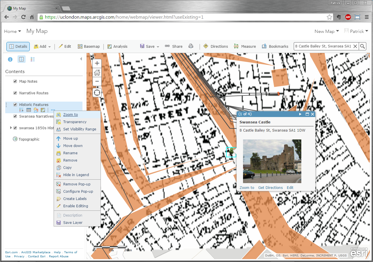
Contents Panel
As layers of information have been added, you may note that in the Details of the map, the Contents, which is displayed in the panel to the left of the map has been progressively populated with the names of the various layers. It’s in this area that you may perform actions on your layer, such as:
-Zoom to the ideal zoom level and area that shows all of the layer
-Adjust its Transparency, so you may see other layers underneath it
-Set Visibility Range, so that the layer may not be drawn when you are zoomed too far in or out
-Move up the layer so it may be drawn over the other ones listed below it
-Move Down the layer so it is draw under the other ones listed before it
-Rename the layer
-Remove the layer
-Copy the layer
-Decide whether you want to Show/Hide in Legend the symbols that represent features of the layer in the map’s legend
-Remove Pop-up windows for the layer that show its features’ information
-Configure Pop-up windows so they display information in the manner you set
-Change Symbols that represent features of the layer to a new representation
-Create Labels for the features based off of its information
-Disable/Enable Editing of the layer
-Show Table of attributes associated with the features
-Pull up a Description of the layer
-Save Layer as a new layer in ArcGIS Online
(Note: Some of these actions may not be available to be performed on the layer based on the type and/or permission of actions on the layer. For example, you may not Change Symbol for layers made publically available on ArcGIS Online or when you Add Layer from Web as they are coming from a different source and only the distributors of those layers may change their symbols)